**ALL WORDS & INFORMATION BELOW COPIED FROM SIGNS POSTED AT PARK**
Known timeline at El Pilar:
1000 B.C. – First Established occupation across the Maya forest
700 B.C. (Early Pre-Classic) – First public monuments established at El Pilar
- First constructions at Xikna
- Earliest occupation of Tzunu’un household
- First occupation of Tikal – 30 miles west
250 B.C. (Pre-Classic) – Public monuments at Tikal constructed
- Plaza Copal designed and completed at El Pilar
- Xikna expanded at El Pilar
- Development of Plaza Axcanan at El Pilar
- Major occupation of the El Pillar area
250 A.D. (Early Classic) – Tikal emerges as regional power center in Maya forest
- Maintenance and stability at El Pilar
- Construction at Plaza Jobo at El Pilar
600 A.D. (Late-Classic)
- Major construction on Xikna at El Pilar
- Tikal re-assumes regional power in Maya forest
800 A.D. (Terminal Classic)
- 869 A.D. – Last dated construction at Tikal
- Continued construction at El Pilar until 1000 A.D.

One of the defining features of El Pilar is how the site blends the archaeological monuments of yesterday with the Maya forest of today. This philosophy is easily visible in the main plazas where you can walk beneath the canopy.

Plaza Copal was established in a major phase of development during the Late Pre-Classic period (250 BC – 250 AD). This represents an incredible focus of work and effort, demonstrating the power and importance of El Pilar as a regional center.The buildings around the plaza were repeatedly remodeled over nearly 2 millenia and reached their final appearance in the Late Classic Maya period (600 – 900 AD)


Plazas are an integral part of sites throughout Mesoamerica. These open, easily accessible plazas were important public areas, and served as ceremonial centers and meeting places. Other more enclosed plazas, such as Axcanan, represent exclusive areas within centers of power. Plazas have often been cleared to provide a full view of the monuments.


The majestic temples of the Maya still rule over the forest, a thousand years after they were abandoned. Archaeological research has focused on these ceremonial centers, but where were the living places of the Maya populace? At El Pilar, there is an example of both the power elite and the domestic household. Maya temples were designed and built, they redesigned and rebuilt, over and over again in many phases of construction, creating layers, much like an onion. For example, Xikna was remodeled over 1700 years. Temples are grouped around plazas and usually face the cardinal directions: North, East, South, and West.
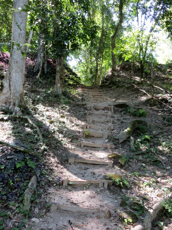
Wooden staircase to Maya temple view
Although many of the monuments at El Pilar have been excavated, most of them remain covered by the forest. When archaeologists expose monuments at El Pilar, they use selective restoration a method that requires less maintenance that complete reconstruction. All exposed monuments must endure the heat and moisture of the tropics, which deteriorate the limestone once it has been exposed. When the Maya inhabited the site, the monuments were plastered and maintained by a fleet of civil servants who would repair the stucco, paint the surfaces, and clean the grounds. Today, El Pilar must rely on the work of a few park rangers to care for all of the structures.

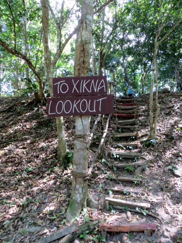
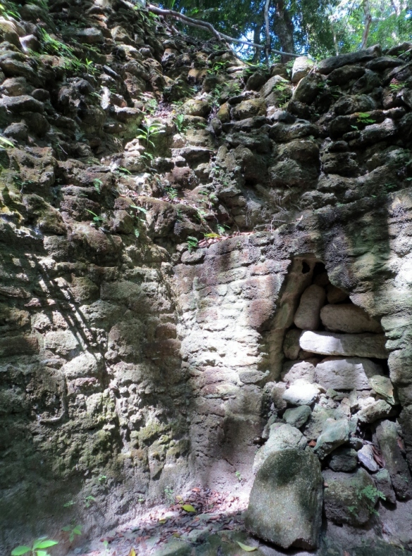
Grave wall at Xikna – El Pilar
In 1983 before restoration a Maya milpa (or farm) existed in Plaza Copal, which was full of corn and clear of trees. Today stands 30 years of jungle rejuvenation.

Plaza Copal at El Pilar

Old School Railing design circa 1000 B.C. Maya

Basket Tie-Tie Rope lashing securing the natural wood railings
Don’t be another Maya sacrifice, watch your step down!
The trees of Plaza Copal range from 8-20 meters and provide an excellent habitat for the many diverse species of birds who live here. Furthermore as you can feel, the shade provided by these trees makes El Pilar a cool respite in the hot, humid tropics. Encouraging the forest canopy at El Pilar makes the reserve more enjoyable for tourists and inviting for wildlife.
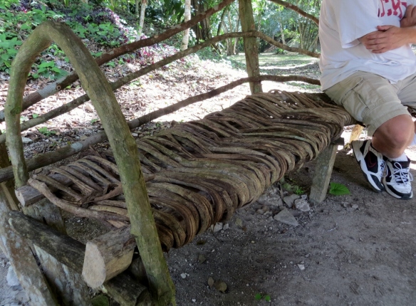
Basket Tie Tie Maya designed bench – natural fibers straight from the jungle vine!
Approximately 800 meters to the west of Plaza Copal is the plaza complex of Pilar Poniente.The western area of El Pilar lies in what is now Guatemala. The two sides of El Pilar were joined by a causeway that runs almost due west and was plastered over in much in the same way of the plazas. The causeway is still visible but covered by thick jungle and and unguarded border crossing!

Wildlife Photos of El Pilar – Lizard on a tree

Orchids in the Canopy

Young Strangler Fig Tree / Vine

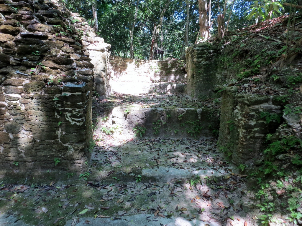
Looters Trench in Maya Monument

Looters trench and tree vines – El Pilar

Sotzna Tunnel – El Pilar Archaeological Reserve

Enterance to Maya tunnel at El Pilar Maya Settlement in Cayo District, Belize

Stepping inside a dark Maya tunnel without a torch!

Excavated and reconstructed Maya tunnel between temples

Plaza Jobo – El Pilar Maya Tour in Western Belize

Royal Residence – El Pilar Maya Site
Reconstructed Maya limestone wall

Arched doorway unique to Maya elite residence
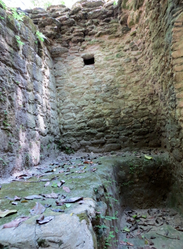
Stone bench inside Maya elite room

View from the top of Kin structure, looking down into elite structure

Arched doorway from inside the Maya room


Kin Maya Temple – El Pilar, Belize

Lookout view of Guatemala from Kin Structure at El Pilar Belize Maya Monument
Birds Without Borders Birding hike at El Pilar, Belize

Maya tour signs are available for self-guided tours
The Maya houses were grouped around plazas or patios where daytime events took place. Each structure faced onto the patio, was built to suit specific needs of the family, and serve domestic purposes. The family compound had an eastern shrine that served their local spiritual needs. The large southern building was suited for receptions. The northern spacious structure would be comfortable for privacy, relaxation, and sleeping. Other buildings are imagined to be fore other household needs like kitchen and storage.

Tzunu’un Maya thatch house with choune tree leaf and tie tie rope

Tzunu’un Maya stone house structure at El Pilar

The Maya Forest Garden at El Pilar

Diagram of the Maya Forest Garden Polyculture Theory by Dr. Anabel Ford
The Maya lived on the same land for thousands of years supporting a population far greater than current density. The Maya Garden at El Pilar demonstrates how the ancient Maya may have worked the land.

Maya Garden Flower

Maya tree identification signs

Maya tree in the forest garden – “Pacaya”
For more information on El Pilar and the archaeology seen there visit the BRASS website.
http://www.marc.ucsb.edu/elpilar/